Weather Forecasting for the Amateur Astronomer
or How I Learned to Stop Worrying and Predict the Future
This article complements a presentation delivered by Blake Nancarrow on 3 February 2021.
See our YouTube channel for the recorded video. Final edited video is available too.
The presentation and this document will provide a set of tools to help predict the weather or sky conditions for astronomy, be it visual astronomy or astrophotography imaging.
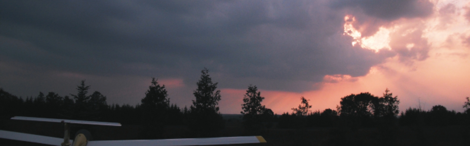
Adjust for Smoke
This presentation was created in the summer of 2020 after a conversation on the RASC Toronto Centre forums. A member said, “The transparency is looking really good tonight.” Blake encouraged members to review fire-smoke data as there were a number of active forest fires. Many of our tools did not adjust predicted transparency values for smoke or particulate.
Poor transparency, of course, impacts viewing or imaging galaxies, diffuse nebula, very faint objects such as the Horsehead Nebula, or comets. That’s in contrast to seeing, an indication of the steadiness of the air, of interest to astronomers chasing planets and double stars.
The Remarkable Barometer
If you only had one tool at your disposal it might be the analog barometer. Once calibrated for your elevation (see the bottom of the page), this old style device shows your current barometric pressure with little pictograms or text for sunny weather, clouds, or rain. That will reflect your current weather—or something imminent. The moveable hand is aligned with the current reading. Later, when viewing the instrument, we will see the change from the previous setting. If the air pressure is rising, good weather is on the way; if falling, the weather will be getting bad. Expect precipitation. If the pressure drops rapidly, take cover!

Most weather web pages and apps along with the nightly TV news often quote the air pressure value, a specific number (e.g. 102.3 kilopascals or 1023.1 hPa), without context. It’s also rare that they state the trend. This “data” is nearly useless. Two decimals? Really?

Some people have home weather stations with an outdoor sensor and a control information panel in the house. Start paying more attention to it. It likely has a barometric pressure indicator with current pressure and trend.
Beyond Civilian Needs
Consider the target audience for the nightly news or the weather snippet in your newspaper.
They are trying to answer basic questions a civilian is asking. Do I need to take my umbrella out today? Do I need to shovel the driveway tomorrow morning? Do I need my parka, toque, mittens, heated vest, hand warmers, wristers, scarf, my woolies for my walk?
Ever seen a report of dew point in the 6 o’clock news? Astronomers need to pay attention to air temperature and dew point calculations. If those two numbers are going to get close together, if within a degree or two, you will need to run your dew heaters on your telescope or lens.
When most weather resources say it’s going to be clear for the next couple of days, they just mean it’s not going to rain.
For astronomers, that's not good enough. We need specific (and unique) information. Invariably, it means we need to be proactive and be ready to dig deeper. Over time, this turns the amateur astronomer into an amateur meteorologist.
You need to build a toolkit, learn how to interpret the data for yourself and understand trends. This means you need to consult a few resources, not just one. It will lead to more successful astronomy sessions. Also, remember weather for Ontario (indeed, Canada) generally prevails from west to east.
Note! All the web site and app snapshots below are STATIC, they are not live...
Clear Sky Charts
Arguably, the most popular and well-known of the tool for astronomers is the Clear Sky Chart (CSC) web site. The many location charts useful, fairly accurate, and come in two flavours.
The full chart shows lots of detail including cloud cover, sky transparency, atmospheric seeing, and darkness. Dark blue is best. White or grey means bad conditions. In the darkness row, you can see daylight and twilight times. The Moon’s presence will lighten some of those dark blue squares.

There's a smoke indicator row where again dark blue is good. There are also indicators for humidity and temperature. Red means high humidity, hot temperatures, and very high wind. Sultry weather.

The mini version of CSC shows the top two rows only, cloud cover and transparency. You have no insight into the seeing.
Clear Sky Charts now go a bit further into the future. Of course, the further we go, the more sketchy it becomes. You have to use guessametrics to figure out what's happening a week from now.
- CSC home page with general info and searching tools
- Toronto chart from Pearson International Airport
- Carr Astronomical Observatory
- David Dunlap Observatory
- Long Sault Conservation Area
- Forks of the Credit Park
- Mew Lake Campground within Algonquin Park
- Algonquin Radio Observatory (ARO)
By the way, the Toronto Centre sponsors the charts for the city of Toronto, the centre’s private observatory, the David Dunlap Observatory in Richmond Hill, and the conservation area north of Bowmanville. We contribute financially which helps pay for some of the computer and internet services.
When you load a chart for a particular location onto your computer, you can hover your mouse pointer over top of the little coloured paint chips to get a pop up. For example, you can determine the percentage of cloud cover. The transparency and seeing are rated out of five. Hover over the darkness square to get the Sun or Moon’s altitude.
If you click on one of the cloud boxes, a map appears with the predicted cloud cover at that time.
The page for a sponsored chart shows additional information. The European ECMWF modelling data is incorporated adding a new row. Also forecast history and past charts are unlocked. Charts update twice a day.
The Canadian product is very popular and is widely used across the continent. There are over 6400 chart locations. All the data comes from Environment Canada (believe it or not) and then is packaged by Attilla Danko, an amateur astronomer like the rest of us.

Brian Gibson of Mississauga has produced a CSC app for the iPhone. It's very good with a nice layout.
UPDATE!
Clear Sky Alarm Clock
In conjunction with Clear Sky Charts accessed manually, you might want notifications from Clear Sky Alarm Clock (CSAC). This takes Attilla Danko’s CSC data and applies criteria. Then when good conditions are headed your way for your favourite locations, you will receive email alerts. In theory, you'll never miss a clear night!
Clear Outside
Clear Outside (CO) is prepared by the First Light Optics company, an astronomy vendor in the United Kingdom. It is quite accurate and completely free. They provide a lot of the information but it rolls into high-level indication.

Immediately obvious are the red, amber, green paint chips making for an easy-to-interpret traffic light system. Green is good. There are little thin bars for Sun and Moon information. The CO tool goes out seven days which is helpful but speculative. At least you can see the Moon phase or illumination.

When you expand a day bar, you are shown three levels of cloud cover, upcoming International Space Station flyovers, precipitation, humidity, wind speed, direction, air temperature, and dew point. They note the air pressure and you can ascertain the trend!

Clear Outside comes with a nice app for Android and iOS. It updates hourly. There's a lot going on in the app, it's a little bit crowded on a small screen but it works.
See the June 2015 RASC Journal for a detailed software review by Blake Nancarrow.
Astrospheric
A relative newcomer to the astronomy weather prediction resources is Astrospheric. This tool can be used for free but paid service unlocks features.

We get information similar to CSC: cloud cover, transparency, and seeing. Uniquely, it adds a KP index row for aurora hunters. There are sinusoidal lines for the Sun and Moon. In fact, when they're synchronised, you're in a new moon phase. The air temperature (orange) and dew point (blue) lines graphs inform you of your dew forecast. The top part of the display emphasises the next couple of nights with the lower section extending to the full week.
- Astrospheric main page
- Halifax, location for BGO, MRO, and ARO
A quirky thing about this webpage is there's an important menu on the left edge beside the map. It may be completely hidden if you're running your browser in a small window. That menu links to smoke charting and a jetstream display among other things.
When you click on a time slot you will notice that the cloud cover map at the top of the screen changes. Also little paint chips will update in colour and with specific numbers. Like a Clear Sky Chart you want dark blue.
You can keep favourite locations too.

There is a mobile app for Android and iOS and it's pretty good, easy to use.
See the August 2018 RASC Journal for a detailed software review by Blake Nancarrow.
Good to Stargaze
With the free version of Good to Stargaze (GTS) you get the conditions for the next evening, just one day. If you pay money, the unlocked version lets you see out one week.

The most unique and powerful feature of GTS is that you can set your own criteria or constraints allowing you to indicate that there's a minimum temperature that you'll tolerate or a particular wind speed that shakes your telescope. You can indicate there's a certain maximum amount of cloud or humidity that you're willing to accept.
These controls make the individual cells in the table go green or red. If there's a single instance of a violation of one of your constraints, then the far-right column, the summary column, will turn red. You simply scan the right hand side of the table. If it's green, head outside; otherwise, clean your eyepieces.
The website does not store locations at this stage (but the app does).
The columns show temperature, humidity, predicted precipitation, cloud cover, and quantifiable seeing and transparency. Imagers might apply threshold values for seeing and transparency.

There's quite a good mobile app. It’s a little bit compressed when you're looking at the main table but excellent information. Again, review the far right-hand column to see if it's going to be good for a few hours. The app offers a useful high-level summary screen for "right now."
See the June 2020 RASC Journal for a detailed software review by Blake Nancarrow.
Aviation Weather Center
The Aviation Weather Center (AWC) satellite imagery is a service provided by the NOAA organization which is part of the National Weather Services. NASA launches the weather satellites and NOAA uses that data and provides weather products. Select the Detroit Windsor (DTW) location to see what's happening over south-western Ontario.

The visual, infrared black and white, and infrared colour snaps and looped images for cloud cover are very helpful. Watch what’s moving in from the west.
In the colour shots, red is good and blue and green are bad. If you can see down to the ground for your area, that’s real good! Big blobs of blue, green, and yellow that means there's cold clouds in the atmosphere above the territory. In forest fire season, you will notice smoke drifting through.
Environment Canada
In many ways this is the horse's mouth. This is where most weather data comes for your favourite weather tools and sites and apps. In other words, the other weather tools use Environment Canada (EC) sources! Why not come here first and interpret it yourself.
Again keep in mind EC collects information for astronomers and we should feel rather privileged. They predict transparency and seeing conditions along with all the other usual stuff.

Visit the page for your observing location to review the day time current temperature, the current humidity, the predicted low temperature for the evening, and the calculated dew point. Air pressure is noted with trend information—thank you. Look at what's going on for the next couple of evenings for weekend planning. For a single night plan, look at the weather for the evening and the next morning.
EC appears to use the little weather icons very accurately: when you see a Moon with stars and no clouds, that means it's going to be transparent!
- EC home page
- satellite imagery
- jet stream map, which affects seeing
- Toronto, read from PIA
- radar from King City
- the astronomy page!
EC seems a little bit pessimistic so consider that when reviewing their data.
It appears they have an app but the author has not tried it.
No Single Tool
Examine a column in the table. The first is for the Clear Sky Chart. It does not show green all the way down.

CSC does not support long-range planning (is that good or bad?). While it shows moonlight, it does not state the Moon phase exactly. It predicts humidity levels but does not show the specific dew point. No barometric pressure and nothing about the jetstream (which impacts seeing). So, the CSC is great but you may want to consult other tools.
No single tool gives us all the information that we need so you need to collate from multiple sources. Then you can do your own analysis. Sometimes they contradict each other which can be challenging and you may detect biases.
In the summertime we need to consider the smoke factor.
CSC Smoke Warnings
If there is prominent smoke from forest fires that can affect your Clear Sky Chart, a warning note appears below the full chart. Watch for the red highlighted text.
Remember to examine the smoke row in the CSC full chart and then subtract that effect from the predicted transparency.
Canadian Smoke Forecast
Visit the animated smoke predictor website.

This shows where the fires are burning, how many, and how smoke is moving.
Hazard Mapping System Fire and Smoke Product
The US and A has an equivalent resource called the Hazard Mapping System (HMS).

Like the Canadian tool, it can be animated. Note the legend for the degree of smoke.
Portal Pages
If you're handy with HTML, you might make a portal page. Make personal ones; make one for your club or centre observatory. Collect together all the information you need, like the Environment Canada information panels, the mini Clear Sky Charts, the mini Clear Outside charts, aurora oval display, Moon phase, etc. with hyperlinks to additional resources.

Then enjoy one-stop shopping.

The Carr Astronomical Observatory uses a Davis weather station to collect immediate data and to show historical charts. It is easy to see the trend of the barometric pressure.
Desktop Tools
You could have automated tools on your Windows desktop. A general application called Rainmeter offers many “applets” including an analog clock, Moon phase widget, and local weather panel.

Blake created custom apps for the mini Clear Sky Charts and hacked the weather tool. When doing other work on the computer, it’s easy to keep tabs on the weather and sky predictors.
Portable Devices
Years ago, Blake delivered talks on the Oregon Scientific and the OneWorld portable weather stations. See his presentations page for more info.

Weather data in your pocket with some prediction capabilities, portable devices are handy at the telescope, in your observatory, or on camping and hiking trips. Alternatively, use a Weather Rock.
Barometric Pressure Information
The standard, or near-average, atmospheric pressure at sea level on the Earth is 1013.25 millibars or hectoPascals, or about 14.7 pounds per square inch.
Since air pressure decreases with altitude, and is affected slightly by temperature, you need to calculate the reduced pressure for the location and conditions. Use this handy Air Pressure at Altitude Calculator.
Summary
The amateur astronomer will, over time, get good at predicting the weather. Using all of these weather tools combined will help. This will aid in planning night observing sessions, weekend plans, trips to the Carr Astronomical Observatory, camping trips, and so on. Good analyses should make for more successful sessions and fewer long trips to only get rained out.
We need to be proactive. We need to hone our skills. Learn to sift through the data. Experience will give you a high degree of confidence as to what's going to happen over the next two or three nights. Amaze your neighbours and friends and family as you gaze into the future.
Be seeing you.